2026-10-01 東北大学
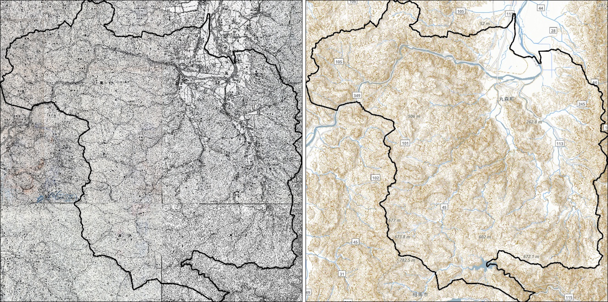
図1.地形復元(明治期と現在の比較)。(左)1908年の歴史地形図。(右)現在の地形図。現在では河道の直線化や堤防・盛土などの地形改変が進んでいる。
<関連情報>
- https://www.tohoku.ac.jp/japanese/2026/10/press20261001-03-modifications.html
- https://www.sciencedirect.com/science/article/pii/S221458182600844X
地形変化が洪水災害と浸水リスクに及ぼす影響の定量化:再構築された歴史的地形を用いたイベントベースの数値シミュレーション Quantifying the impact of landform modifications on flood hazards and exposure: Event-based numerical simulations using reconstructed historical terrain
Nilo Lemuel J. Dolojan, Reika Nomura, Kenjiro Terada, Daisuke Sugawara, Atsushi Kawauchi Yuichi Ebina, Atsushi Suzuki, Atsuko Mizoguchi, Yukiyasu Fujii, Takeshi Kodaka, Shuji Moriguchi
Journal of Hydrology: Regional Studies Available online: 14 September 2026
DOI:https://doi.org/10.1016/j.ejrh.2026.103946
Highlights
- Multi-event analyses quantify empirical thresholds for flooding regime transitions.
- Engineered channels reduce fluvial floods but trap local pluvial rainfall.
- Urban development in historical floodplains doubled built-up flood exposure.
- Structural measures lose their mitigation benefits during extreme typhoons.
Abstract
Study Region:
This study examines Marumori Town, Japan, situated within a 273.46 km2 catchment basin drained by the Abukuma River. Over the past century, this historically flood-prone landscape underwent extensive anthropogenic modifications, with meandering channels straightened and confined by levees to support urban and agricultural development.
Study Focus:
This research quantitatively evaluates how historical landform modifications and urban expansion have altered rainfall–runoff behavior and flood exposure. A high-resolution hydrologic model simulated 35 actual rainfall events on both a reconstructed historical (1908) terrain and the present engineered landscape, alongside spatial analyses of changes in built-up flood exposure.
New Hydrological Insights for the Region:
Simulations reveal a rainfall- and terrain-dependent transition in flood response. During high-intensity events, modern levees reduce fluvial inundation by confining overbank flow. Conversely, under lower-intensity rainfall, these structures impede lateral floodplain drainage, trapping runoff and exacerbating localized pluvial flooding. Empirically derived intensity thresholds delineate this transition between pluvial- and fluvial-dominated regimes. Furthermore, structural measures modestly reduce overall catchment inundation and decrease mean built-up flood depth by 10%–15%. However, this incentivized a 78% expansion of urban development into active floodplains. Consequently, built-up flood exposure more than doubled across most events, demonstrating the “safe development paradox.” Finally, during extreme design-exceedance events like the 2019 Typhoon Hagibis, infrastructure benefits rapidly diminish, producing widespread inundation comparable to the unmodified historical landscape.