2026-09-16 東北大学
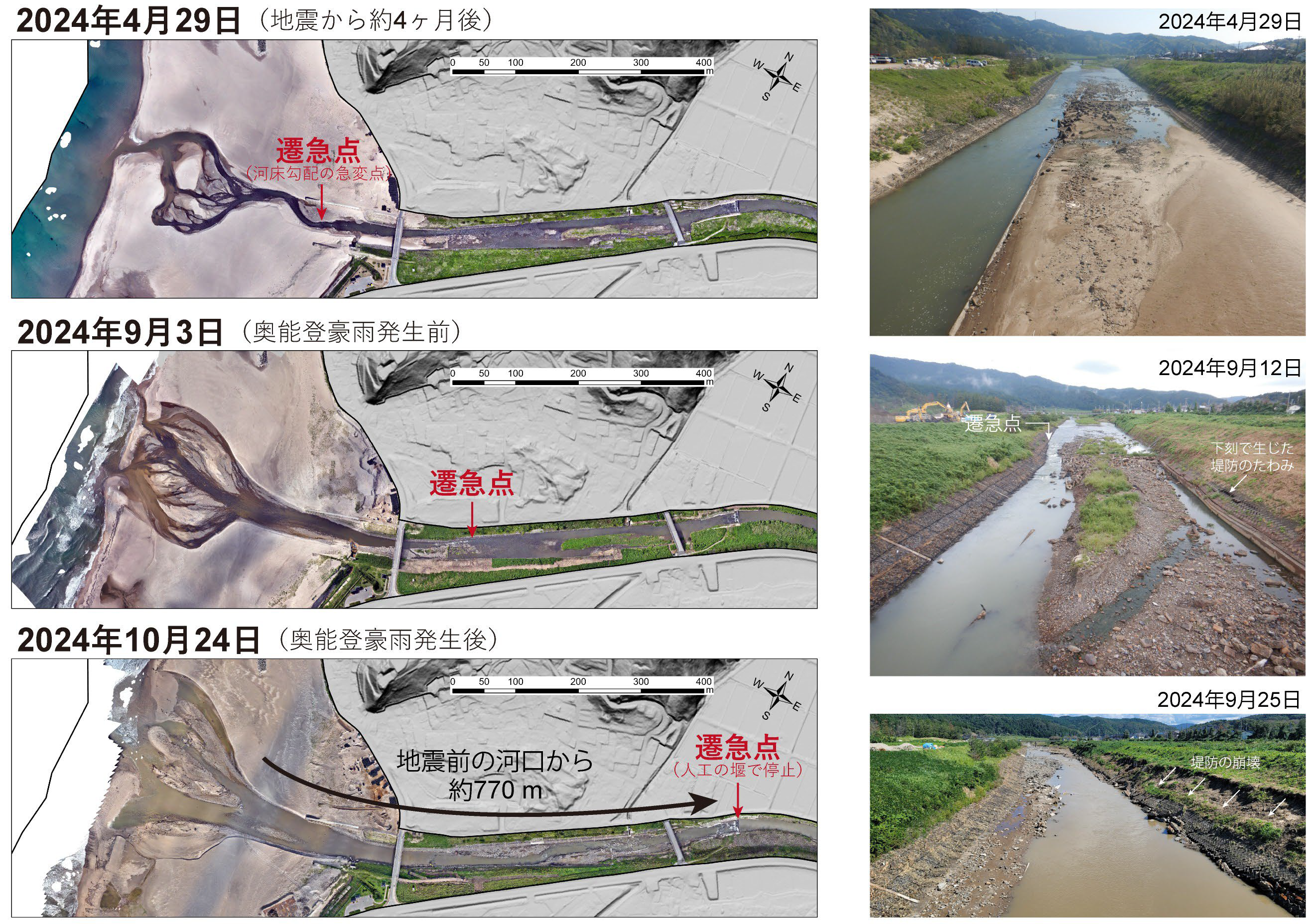
図1. 八ヶ川における能登半島地震発生後1年間のUAV画像と現地の様子
※2026年9月16日17時頃に図版を差し替えました
<関連情報>
- https://www.tohoku.ac.jp/japanese/2026/09/press20260916-02-coseismic.html
- https://www.nature.com/articles/s43247-026-03919-9
2024年能登半島地震時のメートル規模の同震性沿岸隆起に対する河川の急速な反応 Rapid fluvial response to meter-scale coseismic coastal uplift during the 2024 Noto Peninsula earthquake
Takayuki Takahashi,Takuro Ogura,Kotaro Iizuka,Yoshiya Iwasa,Yuichi S. Hayakawa,Tatsuto Aoki & Nobuhisa Matta
Communications Earth & Environment Published:14 September 2026
DOI:https://doi.org/10.1038/s43247-026-03919-9
Abstract
The response of river profiles to relative base-level change is a key topic in earth surface processes, but observations capturing these changes on unconsolidated deposits at a 1–10 years timescales are scarce. We monitored geomorphic changes at the Hakka River mouth after the 3.5-meter base-level fall caused by coseismic uplift of the 2024 Noto Peninsula earthquake, Japan. Utilizing uncrewed aerial vehicle surveys, we documented a maximum vertical riverbed lowering of 2 m and knickpoint upstream migration of 770-m within the first-year post-earthquake, primarily triggered by erosion during major floods that followed the earthquake. Our findings demonstrate that fluvial terraces can develop within a year or less, following co-seismic coastal uplift. However, the river has not yet reached a renewed graded stage because riverbed armoring resulting from sediment sorting during incision currently inhibits further incision. We suggest that the abandonment of alluvial plains and lowering and widening of the riverbed in the lower 10-km segment will continue over the next decade.