 0904河川砂防及び海岸海洋
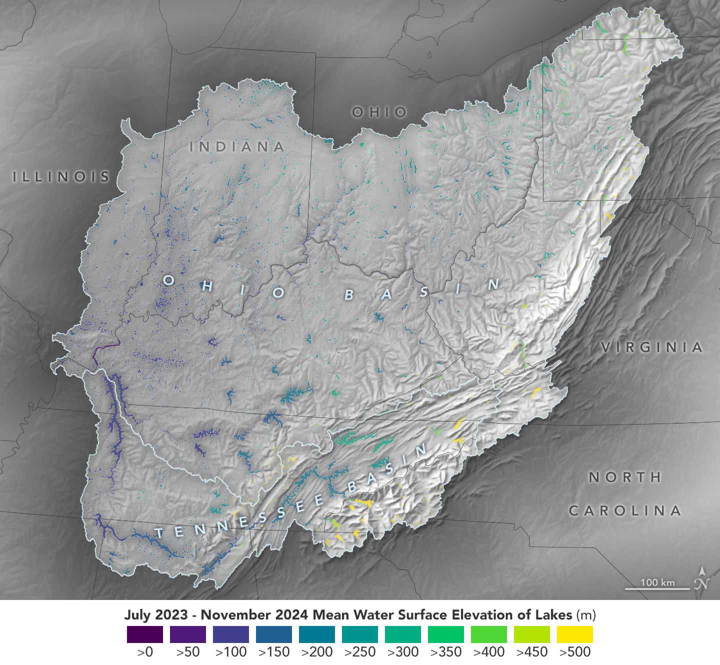
 斬新な衛星がオハイオ川流域の湖水位を追跡(Cutting-Edge Satellite Tracks Lake Water Levels in Ohio River Basin)
2024-12-17 NASAData from the SWOT satellite was used to calculate average water levels for lakes and reservoirs in the O...
 0904河川砂防及び海岸海洋
  0904河川砂防及び海岸海洋